Könntest du die aktuelle Installationsdatei zur Verfügung stellen?
Beiträge von Basti
-
-
Sollte dir nichts bringen, da die Aktivierung nicht gelingen wird.
-
Ich habs ignoriert.
-
-
Zugegeben: PFPX hat bereits einige Jahre auf dem Buckel. Dennoch gibt es meiner Meinung nach noch immer kein besseres Werkzeug auf dem Flugsimulatormarkt, welches eine individuelle Routenplanung auf der Langstrecke erlaubt. Die ermittelte Route lässt sich dann natürlich - zeitgemäß - in Simbrief überführen.
Leider fehlt seit einiger Zeit die Option, aktuelle Wetter- und Forecastdaten kostenpflichtig zu abonnieren, womit das Tool für mich seither unbenutzbar ist.
Das kostenlose Programm wx2pfpx von aloys-c, erhältlich auf Github, bietet hier endlich Abhilfe, indem es aktuelle Wetterquellen von NOAA GFS (Global Forecast System) und NOAA AWC (Aviation Weather Center) für etwa 5000 Airports anzapft und in einen "fake" Active Sky Export überführt. Dieser lässt sich dann problemlos in PFPX integrieren, sodass darauf basierend dann windoptimierte Routings errechnet werden können.
GitHub - aloys-c/wx2pfpx: A simple weather data provider script for the discontinued Professional Flight Plan X software.A simple weather data provider script for the discontinued Professional Flight Plan X software. - aloys-c/wx2pfpxgithub.comDirektlink zum Download: https://github.com/aloys-c/wx2pfp…pfpx-v2.6.3.zip
 ZitatAlles anzeigen
How to install :
The folder can be placed anywhere on the computer, a shortcut to the "wx2pfpx.exe" file can be created and put on the Desktop for quick access. The output files are generated and stored in the folder named "output". This folder has to be selected in the PFPX as the "Active Sky" folder (settings on lower bar of screen), the data displayed in PFPX is then automatically refreshed each time the data is updated.
How to use :
PLEASE NOTE : the program freezes sometimes during processing, this is not an issue, just be patient, the download can sometimes take a few minutes or be rejected by the data provider.
Open the script by double clicking on wx2pfpx.exe or the created shortcut on the Desktop.
The script keeps track of last downloaded data and they can be directly browsed, if available, by using the cursor on the to left through the different forecast times, thiw will change the displayed data in PFPX.
To download new data, you have the following options :
- select a starting time (up to 24 hours in the future).
- The number of forecasts you want to fetch (steps of 3 hours from the given starting time).
- Using either an optimized sample of the grid (default stations and airports network) or importing the full grid.
Clicking on the download button will generate a new dataset that will be saved on the Hard Drive and replace the previous one.
When available for an airport, the METAR and TAF data is also displayed.
Keep in mind that the weather data source is a free, but limited service. It is designed to prevent abuse and making a lot of requests will increase downloading time or make it fail.
How it works :
The script fetches raw weather data, data from the NOAA GFS (Global Forecast System), US national weather service, which is then compiled to a single file that can be imported in PFPX. The data source is updated 4 times a day, and provides forecasts for every 3 following hours up to 16 days. The METAR and TAF data is imported from the NOAA AWC (Aviation Weather Center) for about 5000 main airports.
The default stations network consists of about 15000 reference airports as well as more than 500 additional stations located in remote areas (See default network image file). Wind/temperature data is provided for each of them by using a weighted interpolation of the NOAA grid data (resolution of at least 1°/~111km, 65160 points, but can be changed in the settings up to 0.25°/28km, 1042560 points.). Imported data is then extrapolated in a grid by PFPX. This method allows to process the data quickly and in an optimized way, covering mostly the whole map and fits well for flying on continents.
For more precision, it is also possible to generate an output file containing the whole NOAA grid dataset by checking the "Use full grid" option. This takes more time to process and load into PFPX (especially for higher grid resolutions), but will cover precisely and homogeneously the whole map. That method could fit better for long haul flights over remote areas.
Please note that the data is provided only up to FL400, higher altitudes will have lower precision, and data can be assumed invalid from FL420-FL450 up.
Main differences with official server :
- Only one single forecast can be displayed and used to compute the whole flight performance.
- When the METAR data is unavailable for an airport, usually the data from the nearest airport is automatically displayed. Here the data is simply not provided.
- The general quality/compatibility, please pay for the official subscription if you can afford it, it will give you what's best and allows to reward the team for their work.
Advanced settings :
You can edit the file "settings.cfg" as a normal text file. It allows to set the resolutions of the grid used for data interpolation on stations (1°/111km, 0.5°/55km, or 0.25°/28km), and also the grid imported when using full grid mode (see documentation folder for exemples of grid effect on precision). Increasing resolution can make processing and loading times much higher, 0.25° resolution is not available for full grid mode as data amount is too high for PFPX.
Other settings are available as well like allowing to export the whole data in JSON format, setting the default forecast time used when starting time is left blank or keeping a number of previous forecasts.
Troubleshooting :
- If you don't get result files in the "output" folder after the download and can't restart the app, this is very probably due to the antivirus software preventing the script from writing files. Try to whitelist and empty the "output" folder before trying again.
- Using a higher resolution can make the script lag depending on your computer, try setting the values at 1 and see if it solves the issue.
-
Oh ja wie in guten alten Zeiten auf dem Eulen-Battlefield-Server bis tief in die Nacht als Eulen Squad Siege of Shanghai unsicher machen.

Bin auch auf das Multiplayer reveal gespannt.
-
Zitat
Erlebe die brutale Zerstörung durch Pax Armata, dem weltweit führenden privaten Militärunternehmen. PAX betreibt die Zerstörung der NATO und ihrer Verbündeten und schreckt getreu seinem Motto vor nichts zurück: ""Unser Schutz, euer Frieden."" Geladen und entsichert: Mach dich bereit für das ultimative All-Out-Warfare-Erlebnis. Trage intensive Infanteriegefechte aus. Bestreite Luftkämpfe am Himmel. Zerstöre deine Umgebung für einen strategischen Vorteil. In einem Krieg mit Panzern, Jets und riesigen Arsenalen ist dein Squad die tödlichste Waffe. Das ist Battlefield 6.
Der Trailer bietet auf jeden Fall schon mal einen guten Vorgeschmack. Ich hätte mal wieder richtig Bock auf einen Battlefield Teil der Gegenwart so wie aus guten alten Battlefield 3 und 4 Zeiten.
Externer Inhalt www.youtube.comInhalte von externen Seiten werden ohne deine Zustimmung nicht automatisch geladen und angezeigt.Durch die Aktivierung der externen Inhalte erklärst du dich damit einverstanden, dass personenbezogene Daten an Drittplattformen übermittelt werden. Mehr Informationen dazu haben wir in unserer Datenschutzerklärung zur Verfügung gestellt. -
Ich würde sagen, der Mod ist nur für Leute, die den Sinn und Zweck von UTC nicht raffen.

-
Ich bin gerade fast 19 Stunden von Singapore nach JFK geflogen nur um am Ende die reinste Blurry Matsche Pampe zu haben. Der Flugsimulator war unfliegbar. Kennt jemand das Problem nach sehr langen Flügen? Was kann man dagegen unternehmen?
-
Was ich nicht verstehe: Die Zeitzone ist doch komplett unerheblich, wenn man in der Fliegerei die UTC als Referenz nimmt.
-
Hallo,
die Monate der taghellen Nächte des Nordens sind angebrochen.
Schon vor fast vier Jahren released bietet das World Update V zahlreiche tolle sehenswerte Ziele. Unter anderem ENSB - Svalbard mit seinem Flughafen Longyearbyen.
Der Flughafen Longyearbyen – Das Tor zur Arktis
Der Flughafen Longyearbyen (offiziell Svalbard Lufthavn, Longyear) ist der nördlichste kommerzielle Flughafen der Welt und liegt auf der Insel Spitzbergen im norwegischen Archipel Svalbard, rund 1.300 Kilometer vom Nordpol entfernt. Er wurde 1975 eröffnet und spielt eine zentrale Rolle in der Versorgung und Erreichbarkeit der Region.
Trotz seiner abgelegenen Lage bietet der Flughafen regelmäßige Linienflüge nach Oslo und Tromsø, meist durch Norwegian und SAS. In den Sommermonaten gibt es zudem Charterverbindungen, insbesondere für Touristen, die die beeindruckende arktische Landschaft erkunden wollen.
Die Landebahn ist asphaltiert und etwa 2.500 Meter lang – ausreichend für größere Passagiermaschinen. Der Flughafen ist modern ausgestattet, aber vergleichsweise klein, mit begrenzten Serviceeinrichtungen. Aufgrund der extremen klimatischen Bedingungen und der Polarnacht im Winter gelten besondere Vorschriften für Navigation und Betrieb.
Der Flughafen Longyearbyen ist nicht nur eine wichtige Lebensader für die Bewohner der Region, sondern auch Ausgangspunkt für wissenschaftliche Expeditionen, Polarreisen und Abenteuer in einer der letzten großen Wildnisse der Erde.
Screenshot (21).pngScreenshot (22).pngScreenshot (23).png
Im Übrigens gibt es tolle RNAV Approaches - Authorization Required
Screenshot (25).pngScreenshot (24).png
Ihr benötigt lediglich das World Update V.GSX Profil: https://flightsim.to/file/86622/sva…x-profile-asobo
Ich wünsche viel Spaß.
-
KLM941 21:51
VOI612 21:54
DCM27L 22:00 Glückwunsch Boris
SWA242 22:04
VOI310 22:07
HAL1055 22:11
VIV712 22:14
AMX2501 22:16
VIV824 22:20 Bitte Kochen
-
(FPL-VOI612-IS
-A320/M-SDE3FGHIRWY/LB1
-KSFO1745
-N0449F370 SSTIK5 SUSEY DCT AVE DCT MZB J1 TIJ UT18 AVTEN AVTEN1B
-MMHO0156 MMCU
-PBN/A1B1C1D1O1S1 DOF/250528 REG/N518VL EET/KZLA0025 MMZT0058 SEL/FMHQ CODE/A6810D OPR/Y4 PER/C RMK/TCAS) -
(FPL-DAL612-IS
-A359/H-SADE2E3GHIJ1J4J5M1P2RWXYZ/LB1D1G1
-RJTT1255
-N0488F370 ROVER3A INUBO Y830 LAPIL OTR13 SEALS DCT 35N150E 34N160E/N0482F390 32N170E 30N180E 27N170W DCT ECEDO DCT LIH DCT
-PHLI0647 PHNL
-PBN/A1B1C1D1L1O1S1T1 NAV/Z1 GBAS DAT/1FANSE2PDC SUR/RSP180 260B DOF/250521 REG/N502DN EET/KZAK0227 32N170E0257 30N180E0404 27N170W0513 PHZH0600 SEL/ELFP CODE/A641B6 OPR/DL PER/C RALT/UHPP PMDY RMK/AGCS TCAS II EQUIPPED NRP USA) -
Liebe KuMi Gemeinde,
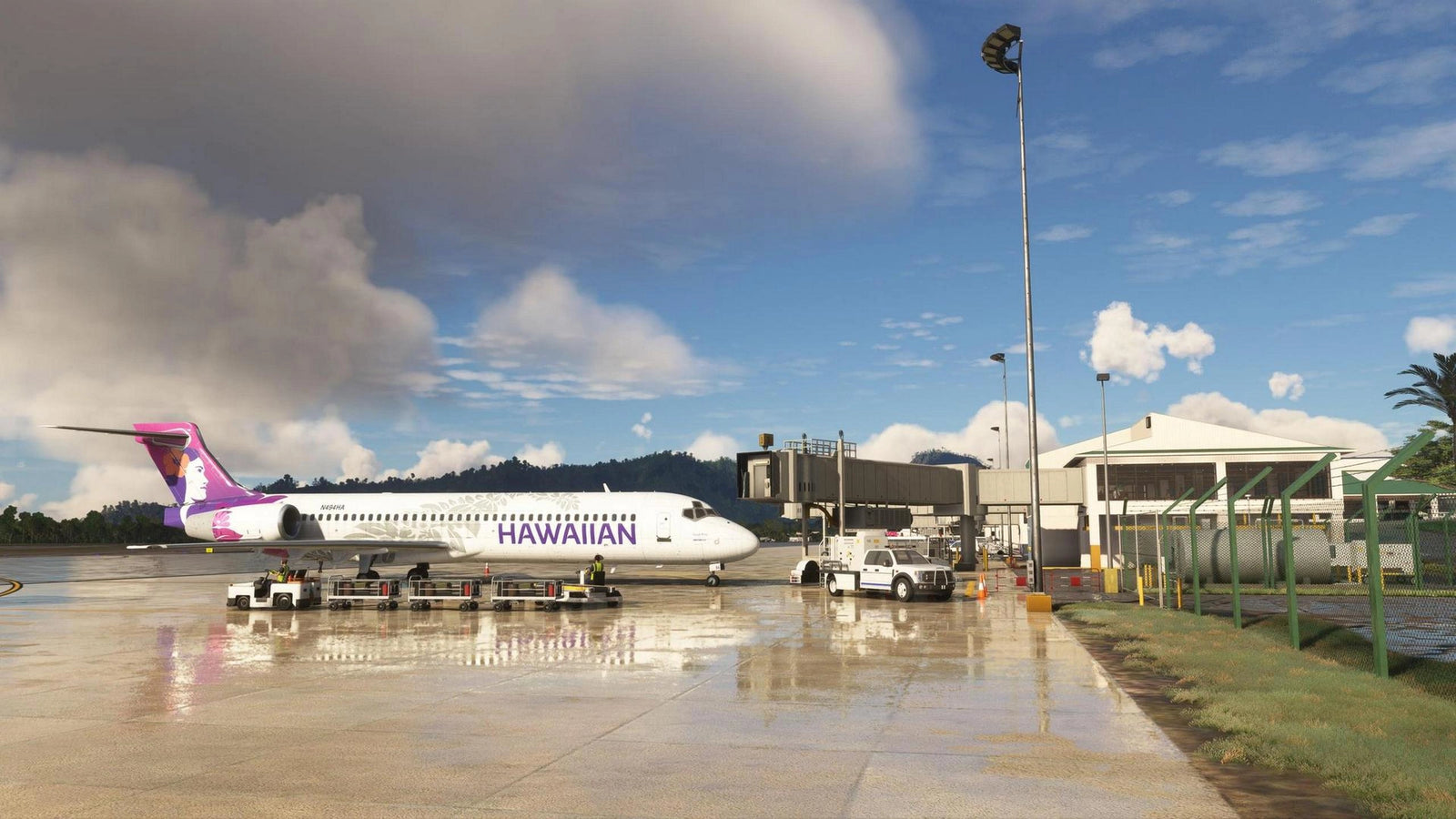
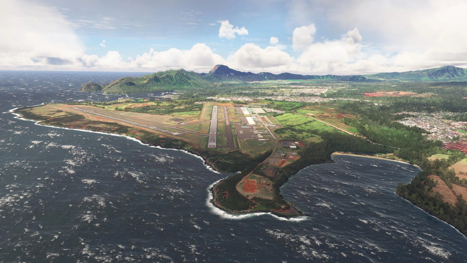
Kauaʻi, die älteste der hawaiianischen Inseln, verzaubert mit ihrer unberührten Natur, üppigen Regenwäldern und spektakulären Küstenlandschaften. Als „Garteninsel“ bekannt, bietet sie eine perfekte Mischung aus Abenteuer und Entspannung – ob beim Wandern entlang der dramatischen Nā Pali-Küste, beim Erkunden tiefer Canyons wie dem Waimea Canyon oder beim Genießen der entspannten Atmosphäre in kleinen, charmanten Orten. Diese Reise nach Kauaʻi verspricht unvergessliche Eindrücke und eine wohltuende Auszeit vom Alltag.
Es geht also zum bislang von uns noch nicht erkundeten Airport PHLI - Lihue.


Eine super Scenery für den MSFS gibt von Northern Sky Studio:
PHLI Lihue Airport MSFS by Northern Sky Studio | Contrail ShopPHLI - Lihue Airport v1.2.0 add-on for Microsoft Flight Simulator created by Northern Sky Studio. Simple installation with the Contrail App!contrail.shopIch wünsche uns viel Spaß!
-
Der AP disconnect befindet sich am Sidestick

-
Viel Spaß euch allen heute Abend! Für uns geht's gleich nach in den Flieger nach Chania.

-
Liebe KuMi Gemeinde,
Wenn es eines gibt, was der neue MSFS seinen Vorgängern wirklich voraus hat, dann ist es die oftmals hervorragende Standard-Szenerie. Durch World Updates und handcrafted Airports fügt Microsoft dem Simulator immer wieder tolle Airports und Landstriche hinzu - und das ganz ohne Aufpreis. Ich bin immer wieder aufs Neue begeistert!
Das Ziel des kommenden Mittwochs gehörte jedoch bereits zum allerersten World Update 1: Japan. Enthalten ist nämlich auch der Nagasaki Airport. Desweiteren ist ein Enhancement Paket auf Flightsim.to verfügbar. Ich verlinke euch unten alles.
Screenshot (18).pngScreenshot (20).png
- Scenery MSFS: World Update 1 installieren

- RJFU NAGASAKI Airport Enhanced: https://flightsim.to/file/37904/rjf…irport-enhanced
- Ebenso erforderlich: Japan airports Model Library KRC https://flightsim.to/file/34494/jap…s-model-library
- GSX Profil: https://flightsim.to/file/64949/gsx…k-in-and-de-ice
Ich selbst werde leider nicht mitfliegen, sondern mit meiner Familie auf dem Weg nach Kreta im Urlaub sein. Ich wünsche euch viel Spaß!
- Scenery MSFS: World Update 1 installieren
-
Toto, beruhig dich! Die Hälfte der Meute geht bei der Bahnlänge eh im Pazifik baden...

-
(FPL-DLH612-IS
-A359/H-SADE2E3GHIJ1J3J4J5M1P2RWXYZ/LB1D1
-PANC1040
-N0499F360 DCT HOM DCT 57N160W 51N170W 42N180W/N0483F380 36N175E 29N170E 20N165E/N0486F400 10N160E DCT WRENS DCT
-PTPN0902 PKMJ
-PBN/A1B1C1D1L1O1S2 NAV/M2Z1 RNP2 DAT/1FANSE SUR/A2 RSP180 260B CANMANDATE DOF/250423 REG/DAIXP EET/KZAK0201 51N170W0203 42N180W0337 36N175E0432 29N170E0533 20N165E0652 10N160E0819 SEL/AHEM CODE/3C6710 RVR/075 OPR/DLH ORGN/EDDMDLHD PER/C RALT/PMDY PKMJ RMK/NRP TCAS)

